News Blogs
MAPP Webinar
31 Mar. 2023, 09:00-14:00 CET
Mar. 2023. Webinar title: “Aerosol Monitoring and Effects on Climate/Air Quality”
Download the webinar flyer for the registration and live streaming links.
MAPP Project Meeting 5
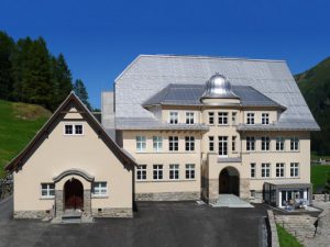
11 – 12 May 2023, PMOD/WRC
Dec. 2022. The final MAPP project meeting will be held from 11 – 12 May 2023 at PMOD/WRC, Davos. Full details of the event will be available soon.
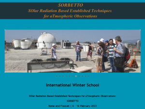
Int. Winter School 6 – 10 Feb. 2023, Rome and Frascati
Oct. 2022. The SORBETTO (SOlar Radiation Based Established Techniques for aTmospheric Observations) Winter School will be organised by ISAC-CNR, and held in Rome and Frascati. Full details of the event can be found here:
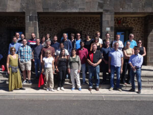
MAPP Meeting and Field Campaign, Sep. 2022, Tenerife
Sep. 2022. PMOD/WRC is participating in an International field campaign at the High Altitude Observatory of Izaña, Tenerife in the frame of the MAPP project. During 3 weeks, continuous solar and lunar radiation measurements will be used to produce new solar and lunar reference spectra and to validate laboratory-based and field calibrations of the participating radiometers and spectroradiometers.
MAPP Paper Published
in the Journal Metrologia
Jun. 2022. A paper entitled “SI-traceable solar irradiance measurements for aerosol optical depth retrieval” was published in Metrologia.
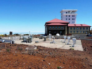
MAPP Campaign
3 – 24 Sep. 2022, Izana
Dec. 2021. A MAPP campaign will take place from 3 – 24 Sep. which is concerned with field measurements of traceable TOA solar and lunar spectra. The 4th MAPP project meeting will simultaneously take place from 8 – 9 Sep. 2022.
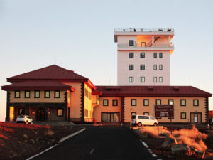
MAPP Project Meeting 4
8 – 9 Sep. 2022, Izana
Dec. 2021. The 4th MAPP project meeting (PM4) will be held from 8 – 9 Sep. 2022 at the Izana atmospheric observatory (Teneriffe, Spain). A MAPP campaign will also take place from 3 – 24 Sep. which is concerned with field measurements of traceable TOA solar and lunar spectra.
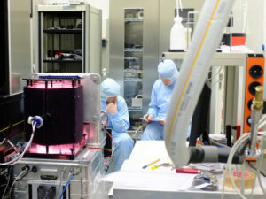
Calibration Measurements at PTB planned for March 2022
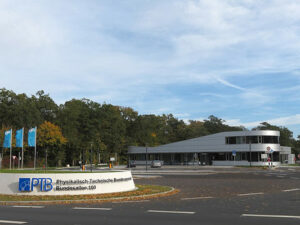
Dec. 2021. The QASUME spectroradiometer System will be calibrated at the TULIP (Tuneable Lasers in Photometry) facility at the PTB in March 2022.
The picture shows a previous measurement campaign at PTB in 2013.
MAPP Project Meeting 3
Nov. 2021, Braunschweig
22 – 23 Nov. 2021. The 3rd MAPP project meeting (PM3) was held from 22 – 23 November 2021. The event was a hybrid event with online and onsite participation at PTB (Braunschweig, Germany).
MAPP Campaign
Sep. 2021, Rome
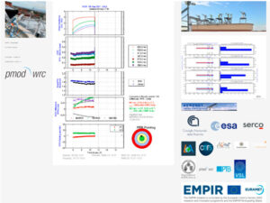
Sep. 2021. A MAPP measurement campaign took place in Rome, Italy. PFR and CIMEL solar photometers measured alongside each other for several weeks. For live data follow this link:
https://www.pmodwrc.ch/en/world-radiation-center-2/worcc/gaw-pfr/mapp_rome/
International Summer School
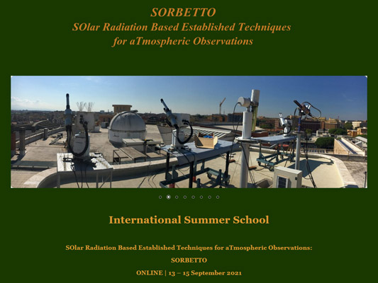
13 – 15 Sep. 2021, Rome
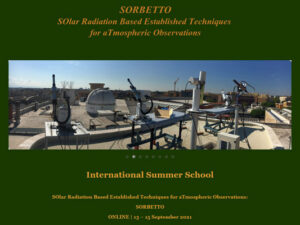
The SORBETTO (SOlar Radiation Based Established Techniques for aTmospheric Observations) Summer School was held at ISAC-CNR in Rome. Full details of the event can be found here:
Calibrations at PTB
Feb. 2021, Braunschweig
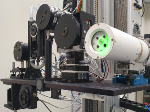
Feb. – Mar. 2021. The calibration of spectrophotometers from the GAW-PFR (shown in picture) and AERONET networks began at PTB. The tunable laser setup, TULIP, with a ps-OPO laser system was used. The aim of the measurements was to achieve a calibration uncertainty of 0.1 – 0.5%.

MAPP Project Meeting 2
Feb. 2021, Online
10 – 11 Feb. 2021. The 2nd MAPP project meeting (PM2) was held online from 10 – 11 February 2021. Due to COVID restrictions, the planned physical meeting at PTB (Braunschweig, Germany) had to be replaced with a virtual meeting. We hope to visit PTB at a later stage in the project.
MAPP Kick-Off Meeting
Jun. 2020, Online
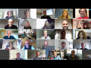
9-10 Jun. 2020. The first MAPP meeting, the Kick-Off, was held from 9-10 June 2020 as a WebEx conference. More than 20 participants from the MAPP consortium participated in the successful meeting, organised by the MAPP coordinator, Julian Gröbner (SFI Davos, Switzerland).
Overview
The overall aim of the project, Metrology for Aerosol Optical Properties (MAPP), is to enable the SI-traceable measurement of column-integrated aerosol optical properties retrieved from the passive remote sensing of the atmosphere using solar and lunar radiation measurements.
In order to validate and improve the current aerosol optical property retrievals using state-of-the-art inversion models, radiometers of the three largest aerosol monitoring networks (AERONET, SKYNET and GAW-PFR) at NMI laboratories will be calibrated, and portable devices for the in-field calibration of network radiometers will be developed.
The goal is to standardise the retrieval of aerosol optical properties by shortening the calibration chain, reduce calibration downtime of network radiometers and establish their consistent dissemination including their uncertainty.
Global climate assessments require harmonised and quality-controlled datasets. This implies measurements preferably traceable to the SI and cross-network wide implementations of calibration and post-processing procedures.
The Need
Global climate assessments require harmonised and quality-controlled datasets. This implies measurements preferably traceable to the SI and cross-network wide implementations of calibration and post-processing procedures.
Atmospheric aerosols are minor constituents of the atmosphere, but a critical component in terms of impacts on the climate. Their properties have been recognised as Essential Climate Variables (ECVs) by the Global Climate Observing System (GCOS). As pointed out in all previous IPCC reports, aerosols continue to contribute the largest uncertainty to estimates and interpretations of the Earth’s changing energy budget.
Long-term monitoring of aerosol ECVs including their uncertainties is needed for observing sensitive changes in the Earth climate system. Currently the three main global surface-based networks measuring column integrated aerosol optical properties in Europe, AERONET Europe, GAW-PFR and SKYNET Europe, operate over hundred stations with complex calibration strategies based on artefact reference devices. The lack of an appropriate metrological framework in the calibration, operation, and data processing of these networks render the whole monitoring concept very convoluted, time consuming, labour intensive, and uncertain.
Calibrations of reference radiometers are performed at only two stations world-wide (Mauna-Loa, Hawaii or Izaña, Tenerife). The subsequent calibration of network radiometers based on such reference artefacts relies on instrument stability and instrument redundancy and not on objective metrological concepts. The current field calibration procedure of calibrating network radiometers at centralised calibration stations outdoors requiring perfect weather conditions means long calibration times and therefore excessive downtime at monitoring stations.
Emerging technologies such as compact array spectroradiometers or portable Fourier spectrometers offer the potential for enhanced atmospheric products providing significantly more information on the radiative forcing impact on climate.
The need for an objective assessment of uncertainties of the retrieved aerosol properties is an inherent property of traceable measurements, which is currently lacking in all three main global aerosol monitoring networks. The databases providing access to the network data do not offer concurrent uncertainty estimates.
Project Objectives
The specific objectives of the project are:
- To develop calibration methods and traceable devices for SI-traceable laboratory and in-field calibrations for radiometers measuring direct solar spectral irradiance and sky radiance, in the spectral range λ = 310-1700 nm with an expanded uncertainty of 1%. Instruments measuring lunar irradiance were included into the scope of the objective following the expressed needs of the stakeholders.
- To validate the methods for zero airmass extrapolation by means of traceable ground-based solar spectral irradiance measurements and comparison to satellite-based solar extra-terrestrial spectra. Due to the growing importance of lunar irradiance measurements to retrieve AOD during night-time conditions (e.g. polar winter), validations of lunar irradiance phase models will also be addressed.
- To develop a comprehensive uncertainty budget for aerosol optical properties, such as aerosol optical depth, aerosol size distribution, and aerosol single scatter albedo, retrieved from remote sensing-based measurements of direct and scattered solar radiation, enabling its inclusion in the corresponding data archives of the aerosol monitoring networks, with the relevant calibration and traceability information.
- To facilitate the take-up of the developed technology and measurement infrastructure developed in the project by the measurement supply chain (NMIs, DIs, and calibration laboratories), standards developing organisations (WMO CIMO, WMO GAW SAG) and end users (e.g. ground-based and space-based remote sensing and atmospheric science communities). In addition, to support the European Metrology Network for Climate and Ocean Observation.
The Goal – Providing SI-Traceability to Atmospheric Remote Sensing of Aerosol Optical Properties

Project Details
Project Name Metrology for Aerosol Properties (MAPP)
EURAMET Project Number 19ENV04
Start date: 1 June 2020
Duration: 36 months
MAPP coordinator: Dr. Julian Gröbner
PMOD/WRC, Dorfstrasse 33
CH-7260 Davos Dorf, Switzerland
Tel: +41 81 417 51 57
E-Mail: julian.gröbner@pmodwrc.ch
MAPP Partners

Funding
This project 19ENV04 MAPP has received funding from the EMPIR programme co-financed by the Participating States and from the European Union’s Horizon 2020 research and innovation programme.
Publications
2022
Overview of the MAPP Scientific and Technical Objectives
The overall aim of the MAPP (Metrology for Aerosol Optical Properties) project is to enable the SI-traceable determination of column-integrated aerosol optical properties retrieved from the passive remote sensing of the atmosphere using solar and lunar radiation measurements. All objectives of the SRT-v10 will be addressed in this proposal. Furthermore, the solar activities will be extended with a lunar component, as this measurement type is becoming increasingly important within these networks to retrieve aerosol properties during night-time, and especially during the polar night.
The specific objectives of the project are:
- To develop calibration methods and traceable devices for SI-traceable laboratory and in-field calibrations for radiometers measuring direct solar and lunar spectral irradiance and sky radiance, in the spectral range 310 nm up to 1700 nm with an expanded uncertainty of 1 % (Work Package 1; WP1). Instruments measuring lunar irradiance were included into the scope of the objective following the expressed needs of the stakeholders.
- To validate the methods for zero airmass extrapolation by means of traceable ground-based solar spectral irradiance measurements and comparison to satellite-based solar extra-terrestrial spectra (WP2). Due to the growing importance of lunar irradiance measurements to retrieve AOD during night-time conditions (e.g. polar winter), validations of lunar irradiance phase models will also be addressed in WP2.
- To develop a comprehensive uncertainty budget for aerosol optical properties, such as aerosol optical depth, aerosol size distribution, and aerosol single scatter albedo, retrieved from remote sensing-based measurements of direct and scattered solar radiation, enabling its inclusion in the corresponding data archives of the aerosol monitoring networks, with the relevant calibration and traceability information (WP3).
- To facilitate the take-up of the developed technology and measurement infrastructure developed in the project by the measurement supply chain (NMIs, DIs, and calibration laboratories), standards developing organisations (WMO CIMO, WMO GAW SAG) and end users (e.g. ground-based and space-based remote sensing and atmospheric science communities). In addition, to support the European Metrology Network for Climate and Ocean (WP4).
Need for the Project
The following challenges are explicitly mentioned in the EMPIR environment call scope, and underline the importance of the proposed activities in this proposal:
- Monitoring of Essential Climate Variables of the atmosphere.
- Monitoring of gases that affect climate and health.
- Developing and validating remote sensing methods for environmental and climate monitoring.
Climate observations, allowing monitoring of ECVs, are critical to our understanding of the climate. Atmospheric aerosols are minor constituents of the atmosphere, but a critical component in terms of impacts on the climate. Their properties have been recognized as Essential Climate Variables (ECVs) by the Global Climate Observing System (GCOS). In addition, aerosol optical depth (AOD) has been defined as one of ten essential climate variables for the ESA Climate change initiative.
The Intergovernmental Panel on Climate Change (IPCC) recommendations
As pointed out in all previous IPCC reports, aerosols continue to contribute the largest uncertainty to estimates and interpretations of the Earth’s changing energy budget.
While in-situ measurements retrieve aerosol properties at the individual particle level, the extrapolation of their total atmospheric impact is very challenging and has not yet been successfully achieved. In contrast, passive remote sensing observations of column-averaged aerosol properties, from scattered and absorbed solar/lunar radiation, directly observe the radiative impact of the whole atmospheric aerosol column. For this purpose, several large-scale aerosol-observing-networks have been created, which monitor the atmospheric aerosol distribution in order to assess their radiative impact on climate.
Traceability and harmonisation of global remote sensing networks for column-integrated aerosol properties
Aerosol optical properties from ground-based passive remote sensing radiometers have been retrieved consistently for the past 20 years: Currently there are three operational global surface-based networks measuring aerosol optical properties: The aerosol robotic network (AERONET) operates 380 permanent stations globally, of which 120 European stations, with central calibration facilities in the USA, France and Spain. The Global Atmosphere Watch Precision Filter Radiometer network (GAW-PFR) operated on behalf of the World Meteorological Organization with a total of 15 stations, of which 7 are European stations. The Sky Radiometer Aerosol Network (SKYNET) operate 101 stations world-wide, including 24 European stations.
Each network has implemented its distinct calibration and measurement strategy, based on measurements of direct sun solar attenuation due to aerosols using a top-of-the-atmosphere calibration constant. This calibration constant determination is relying on in-situ calibrations of reference radiometers using subjective measurement procedures (e.g. zero air mass extrapolation – “Langley method”). While AERONET and GAW-PFR operate reference radiometers to which network radiometers are directly compared to, SKYNET uses in-situ field data to calibrate each radiometer at its measurement site, rendering the quality assurance process very challenging. Other column-integrated aerosol properties are retrieved from sky radiance measurements combined with inversion modelling techniques. For these measurements the radiometers are calibrated using laboratory-based calibration facilities, but they are not homogenized among networks and so far without demonstrating traceability to SI. The inversion algorithms from the two networks have also never been systematically compared to each other.
Lunar photometry is another approach to extend remote sensing capabilities to nocturnal periods, especially in polar regions where the sun is below the horizon for extended periods. A distinct drawback in lunar photometry is related to the variable geometry of the Sun, Earth, and Moon constellation, resulting in the Moon’s phases as seen from the Earth. As a consequence, a precise top-of-the-atmosphere lunar irradiance model is mandatory in lunar photometry. The uncertainty in AOD retrieved using this technique is therefore dependent on the uncertainty of the lunar irradiance model itself.
Referencing satellite-based Earth Observation
Satellite-based instruments have been used in recent years to derive atmospheric aerosol properties. While the retrieval over oceans is producing reliable datasets, the retrieval over other surfaces is still associated with large uncertainties. Therefore, surface-based networks are necessary for providing SI-traceable benchmark datasets to validate and improve satellite-based retrievals.
Support to European Research Infrastructures
The European Research Infrastructure for the observation of Aerosols, Clouds and Trace gases (ACTRIS) is composed of observation stations, exploratory platforms, instrument calibration centres, and a data centre to serve a wide user community working on atmospheric research, climate and the Earth system. It will become fully operational in 2025 and is entering now the commissioning phase. ACTRIS requires fully traceable aerosol properties, of which the column-averaged properties from passive remote sensing measurements are the most advanced ones. Still, traceability to the SI has not been foreseen as it is beyond the capacity of this stakeholder alone, and this proposed project can greatly support the reliability and comparability of ACTRIS findings/measurements.
Justification of the objectives:
- Objective 1: Radiometric characterisation and calibration of sun photometers and spectroradiometers (WP1): The current networks rely on sun photometers purchased from commercial manufacturers. The characteristics of the instruments as given to the customers are based on nominal radiometric parameters. Departure from the nominal values introduce systematic measurement errors and thereby increase the uncertainties of the derived aerosol properties. The irradiance responsivity of the network radiometers is calibrated at a designated calibration facility with an uncertainty of 1% at regular intervals by direct outdoor comparison to a reference radiometer, while the radiance responsivity is calibrated using an indoor calibration with an estimated uncertainty of 3%. Both types of calibrations are not traceable to the SI, but to community accepted artefacts. Furthermore, due to the outdoor calibration process requiring cloud-free atmospheric conditions, the calibration duration often extends several months, resulting in data gaps of up to 4 months, which is extremely problematic when using the datasets for trend analyses.
- Objective 2: Determination of TOA lunar and solar spectra (WP2): Retrievals of aerosol properties from calibrated solar irradiance measurements require a top-of-the-atmosphere solar spectrum at high resolution of better than 0.05 nm and with uncertainties of less than 1%. Currently, no traceable satellite-based solar spectra with uncertainties of 1% or less and with such high resolution are available. Similarly, lunar measurements rely on lunar models which combine a solar reference spectrum, spectral lunar irradiances at specific wavelengths, and lunar phase information (ROLO and RIMO models). These models have estimated uncertainties of the order of 10% that are directly contributing to the AOD retrieval uncertainties and therefore need to be significantly reduced to be usable for the AOD retrieval from lunar irradiance measurements.
- Objective 3: Development of a comprehensive uncertainty budget for aerosol optical properties from remote sensing data (WP3): While a comprehensive uncertainty analysis has been largely achieved for the primary measurands, e.g. solar spectral irradiance and for directly related optical parameters such as AOD, the uncertainty budget for the retrieved geophysical variables, including aerosol optical properties such as size distribution, single-scattering albedo, complex index of refraction, etc. is still not established (the uncertainties of such retrieved parameters are not provided even by well-established observational networks such as AERONET (https://aeronet.gsfc.nasa.gov)). The propagation of solar measurement uncertainties into the retrieval uncertainties is very complex due to the complexity of solar radiation interactions with the Earth’s atmosphere and the inversion modelling retrieval uncertainties themselves. They depend on many factors including the actual state of the atmosphere and the surface properties, which are often not well known and therefore add to the retrieval uncertainties.
Progress beyond the state-of-the-art
Objective 1: Radiometric characterisation and calibration of sun photometers and spectroradiometers (WP1)
Current state-of-the-art: Current aerosol optical remote sensing networks rely either on a strict calibration hierarchy, based on bilateral comparisons between network and reference instruments (GAWPFR and AERONET), or on in-situ calibrations of network radiometers without any link to traceable standards (SKYNET). While the latter procedure precludes any form of metrological traceability, the GAWPFR and AERONET networks have well established procedures for the traceability of network radiometers to the reference radiometers. However, both network and reference radiometers are traceable not to the SI but to artefacts; the calibrations of these radiometers rely solely on the stability and reproducibility of distributed instruments and furthermore, the scheduled re-calibrations, which can last for several months, resulting in significant data gaps in the measurement series.
Progress beyond state-of-the-art: Tuneable laser sources are revolutionising radiometric calibrations. Due to their high costs and operational complexity they are still, however, only used by very few laboratories. The project will provide access to the tuneable laser facilities at PTB, VSL, NPL, and SFI DAVOS for characterising the spectral bandwidth, linearity and stray light of reference radiometers and spectroradiometers of partners and selected end-users of this project. The facility of PTB will also be used to provide spectral irradiance calibrations with uncertainties of 0.1%, a factor of 5 improvement over current realisations.
Monitoring devices using LEDs were developed in the ENV03 SolarUV and ENV59 ATMOZ projects to verify and recalibrate the spectral responsivity of radiometers. This expertise will be used to develop enhanced devices covering the extended wavelength range from 340 nm to 1700 nm of the discrete wavelength channels of the narrowband filter radiometers with expected long-term stabilities of better than 0.1%/year.
The narrowband tuneable portable radiation source developed in ENV59 ATMOZ will be upgraded to cover the extended wavelength range to 1700 nm for characterising the relative spectral bandpass of each wavelength channel of the network radiometers. This unique device will be designed with commercial off-the-shelf components to satisfy the following three mutually demanding criteria: affordability, portability, and robustness.
Several radiometers belonging to the Ocean Colour Measurement Network were calibrated within the ENV04 METEOC-2 project. This project will extend this activity by providing traceability to the radiance calibration facility of the main network calibration centre itself. This will be the most economic and sustainable approach to providing traceable radiation calibrations to the whole network.
Objective 2: Determination of TOA lunar and solar spectra (WP2)
Current state-of-the-art: Currently available top-of-the atmosphere solar spectra show spectral discrepancies of up to 10% between each other and compared to those from ground-based measurements, especially in the NIR. This precludes their use as reference spectra for retrieving aerosol properties, which require uncertainties of better than 2%.
In the past 25 years, a number of satellite experiments have measured the solar extra-terrestrial spectrum from space to avoid atmospheric absorption and scattering effects. While prelaunch calibration and characterisation procedures reach very low uncertainties, once in space the possibilities of verifying or recalibrating such instruments become very challenging. As recent studies have demonstrated, the solar spectra measured from satellite platforms can differ significantly between each other, due to instrument degradation issues arising from the harsh space environment and the difficulties in accounting for possible instrument changes between the pre-flight calibration and its operation in space. In a strict metrological sense, such measurements cannot be considered traceable to the SI since metrological traceability inherently requires the repeated demonstration of the uninterrupted traceability to primary standards, which is currently not available to instruments located in space.
A traceable high-resolution extra-terrestrial solar spectrum with the currently lowest demonstrated uncertainties has been determined within the ENV59 ATMOZ project from ground-based measurements of direct solar spectral irradiance in the spectral range from 300 nm to 500 nm. This solar spectrum has become a benchmark data set for assessing published solar spectra used by the scientific community or measured from satellite platforms.
Similarly, lunar measurements rely on lunar models that combine a solar reference spectrum, spectral lunar irradiances at specific wavelengths, and lunar phase information (ROLO and RIMO). These models have estimated uncertainties of the order of 10%, which need to be significantly reduced to be able to be used to retrieve AOD from lunar irradiance measurements.
Progress beyond state-of-the-art: The objective will be to extend this benchmark solar spectrum to 1700 nm with uncertainties of 1% across the whole wavelength range and thereby provide a definite assessment on a long-held controversy regarding current discrepancies between different solar spectra data sets in the near infrared wavelength range. The expected uncertainty of 1% of this top-of-the-atmosphere solar spectrum will have significant impact not only on derivations of aerosol properties but also on atmospheric modelling applications as a benchmark reference and on assessing solar spectra obtained by current and future solar space missions.
Similarly, ground-based measurements of lunar irradiances have shown that the currently used models for lunar phase irradiances need validation to be useful at the 1% level. Due to the growing importance of lunar photometry to retrieve AOD from lunar irradiance measurements during night time, a validation of the ROLO and RIMO models will be undertaken.
Emerging technologies
Current state-of-the-art: Recently, with the advent of compact spectroradiometers using fixed gratings and detector arrays to measure spectral fluxes, their deployment potential has increased significantly, mainly due to their mode of operation and fast data acquisition of the order of seconds for a complete spectrum. The majority of these compact spectroradiometers were developed for indoor use with very limited temperature and humidity stability.
Progress beyond state-of-the-art: Several companies are currently developing compact and outdoor-compatible spectroradiometer systems for the eventual replacement of currently used narrowband filter radiometers in aerosol monitoring remote sensing networks. For example, several units of the Precision Solar Spectroradiometer (PSR) are currently in operation measuring the direct and global solar spectrum in the range 300 nm to 1020 nm with an uncertainty of 1.8%. Its long-term operation will be investigated in this project along with a thorough validation of the column-integrated aerosol properties retrieved from full spectrum solar irradiance measurements. Likewise, the high-quality Fourier-transform spectrometer Bruker EM27/SUN has recently become available for measuring direct solar absorption spectra in the near-infrared spectral range (e.g., spectrometer covering 5.000-12.000 cm-1 at 0.5 cm-1 of spectral resolution). These precise instruments have been mainly used for monitoring greenhouse gases concentrations, but they are promising systems to derive spectral AOD in the near-infrared spectral range and, thus, to complement the existing aerosol monitoring remote sensing networks. The project will engage with industrial partners and end-users to validate the solar measurements and spectral aerosol retrievals based on these emerging technologies. The aim is to demonstrate spectral AOD retrievals within the uncertainties defined by the WMO
Objective 3: Development of a comprehensive uncertainty budget for aerosol optical properties from remote sensing data (WP3)
Current state-of-the-art: ENV59 ATMOZ developed procedures to determine uncertainties of the atmospheric remote sensing retrievals from direct solar spectral irradiance measurements including correlations among parameters.
A number of studies have been conducted on the evaluation of retrieval uncertainties in the frame of activities dedicated to full standardization and characterization of aerosol products provided by worldwide networks such as AERONET and SKYNET. For example, an extensive uncertainty budget analysis for retrieval of detailed aerosol properties from ground-based AERONET sun/sky-radiometers was performed. Some results clearly revealed the presence of systematic bias in the AERONET retrievals associated with unaccounted effects of non-spherical particles. Recently, in addition to the above studies some significant efforts were put into accessing the uncertainties by comprehensive numerical tests [https://aeronet.gsfc.nasa.gov/new_web/Documents/U27_summary_final. pdf].
Progress beyond state-of-the-art: In the frame of the present project we plan to adapt the dynamic estimates of the uncertainties that will be provided as part of the output for each retrieved aerosol property. The base of such approach relies on the fundamental developments of statistical estimation theory. The concept has been implemented in early AERONET developments. Since the uncertainty of the retrieval depends on a large number of factors in a very complex non-linear way it will be necessary to investigate possible correlations among all these components affecting the retrieval.
In the frame of this project, we plan to adapt and extend the existing GRASP theoretical and software package for providing enhanced estimates of the uncertainties for all parameters retrieved from ground-based remote sensing, i.e. aerosol size distribution, refractive index, etc. Also, we expect to provide a set of diverse derived parameters including total scattering, extinction, single scattering albedo, etc. Moreover, we plan to analyse a possibility to provide uncertainty estimates for such complex GRASP applications as aerosol retrievals from multi-instrument synergetic retrievals.
General References
Overview
The MAPP (Metrology for Aerosol Optical Properties) consortium consists of 14 partners from 9 countries:
6 National Metrological Institute (NMI) / Designated Institute (DI); 8 External partners; 2 Small and Medium Enterprises (SME)
- The core of the consortium was involved in EMRP ENV03 SolarUV (2011-2014) and ENV59 ATMOZ (2014-2017).
- External partners have ongoing collaborations > 10 years.
- The User community is directly involved: project partners are responsible for the main aerosol monitoring networks (Aeronet-Europe, SkyNet-Europe, GAWPFR-PMOD/WRC).
- The Joint Research Project (JRP) consortium realises critical mass with broad experience of leading experts and highly specialised contributions from individual partners.
- Tasks are collaborative and have well-defined objectives to achieve the project deliverables.

MAPP Partners
| Contact | Organisation Abbreviation | Organisation Legal Address | Country | Organisation Web Address |
| Julian Gröbner | SFI Davos | Schweizerisches Forschungsinstitut für Hochgebirgsklima und Medizin, Davos | Switzerland | www.pmodwrc.ch |
| Petri Kärhä | Aalto | Aalto-korkeakoulusäätiö sr | Finland | |
| Marek Šmid | CMI | Cesky Metrologicky Institut | www.cmi.cz | |
| Tom Gardiner | NPL | NPL Management Limited | UK | www.npl.co.uk |
| Saulius Nevas | PTB | Physikalisch-Technische Bundesanstalt | Germany | www.ptb.de/cms |
| Kate Chernysheva | VSL | VSL B.V. | The Netherlands | |
| Emilio Cuevas | AEMET | Agencia Estatal de Meteorologia | Spain | www.aemet.es |
| Monica Campanelli | CNR | Consiglio Nazionale delle Ricerche | Italy | www.cnr.it |
| Philippe Goloub / Oleg Dubovic |
CNRS | Centre National de la Recherche Scientifique | France | www.cnrs.fr |
| David Fuertes | GRASP SAS | Generalized Retrieval of Atmos. and Surface Properties En Abrege GRASP | France | |
| Claire Ryder | UoR | University of Reading | UK | |
| Victor Estelles | UV | Universitat de Valencia | Spain | www.uv.es/termo |
| Carlos Toledanos | UVa | Universidad de Valladolid | Spain | |
| ULILLE | Université de Lille | France |
The scale of the MAPP project requires a strong partnership between NMI/Dis and the ground-based aerosol remote sensing community. The NMI/DI partners of the project have previously worked together, such as in the EMRP ENV03 SolarUV and EMRP ENV59 ATMOZ projects, establishing close collaborations, also outside formal projects. The external partners of this project have been collaborating for many years, among each other and with SFI DAVOS, in numerous projects and committees, which is also shown through the numerous joint publications and comparison campaigns that have been done together over the past 20 years. The institutes joining the consortium and non-NMI-DIs have been specifically chosen because they bring in the essential end-user and stakeholder linkage by being responsible for the European components of the largest global aerosol remote sensing monitoring networks.
SFI DAVOS – is the designated institute of METAS for solar irradiance and will coordinate the project. SFI DAVOS has successfully coordinated the ENV03 SolarUV and ENV59 ATMOZ projects. It is mandated by the WMO to operate the World Optical Depth Research and Calibration Center (WORCC) as one section of the World Radiation Center of the WMO. The purpose of WORCC is to provide traceability of AOD measurements to its reference triad of precision filter radiometers, develop new methods for instrument calibration, to initiate homogenization activities among different AOD networks and to operate a global background network (GAW-PFR) of precision filter radiometers.
Aalto – will provide the project its experience in developing new measurement methods and procedures, gained and demonstrated in the earlier EMRP projects ENV03 SolarUV and ENV59 ATMOZ. Aalto’s unique position as both an NMI and a university laboratory gives it a combination of metrological experience of senior researchers and the new ideas of students.
CMI – is the National Metrology Institute of the Czech Republic, responsible for maintaining and developing National Standards. CMI offers cooperation and metrological services at the highest technical level for all manufacturers, suppliers, laboratories and customers in all areas of science and industry. In the field of Earth Observation CMI offers the long-term experiences in developments of custom-made specialized high sensitivity low noise detection systems for optical radiation (hybrid detector for QUASUME II) and developments of ultra-precise portable calibration instruments (TuPS) for in-field characterization of Dobson spectrometers.
NPL – is the UK’s NMI and bring extensive experience in radiative calibration and measurement in laboratory and field. The Emissions and Atmospheric Metrology Group (EAMG) has deployed its transportable FTIR facility for intercomparisons with Network for the Detection of Atmospheric Composition Change observatories and also at high and low altitude observatories carrying out measurements of down-welling radiation traceable to NPL’s primary radiance scale maintained by the Earth Observation, Climate and Optical Group (ECOG). Both these types of field work have involved significant uncertainty evaluation work, with the aim of better understanding the atmospheres energy budget and provide new tools such as a new top of atmosphere spectrum with fully evaluated uncertainties.
PTB – was one of the major contributors to the previous EMRP projects SolarUV and ATMOZ. It hosts the primary realisation of spectral irradiance unit and maintains diverse calibration facilities including setups based on wavelength-tuneable lasers. PTB has a long-lasting experience in developing LED-based transfer standards as well as in characterisation and calibrations of spectroradiometric equipment.
VSL – is the national metrology institute of the Netherlands and makes measurements results of companies, laboratories and organizations directly traceable to international standards. The optics group of VSL is responsible for the activities on absolute radiometry and provides regularly consultancies and calibrations services to large organizations (such as the European Space Agency) and industry in the field of radiometry. The group maintains facilities for spectral irradiance, optical power calibration (through an absolute cryogenic radiometer) and has developed, in the last few years, new facilities for linearity response, slit function and spectral radiance response calibration of systems.
AEMET – Izaña Atmospheric Research Center (IARC) belongs to AEMET (State Meteorological Agency of Spain). Izaña Observatory (as part of IARC) has been declared in July 2014 as Testbed station for Aerosols and Water Vapor Remote Sensing Instruments by the Commission for Instruments and Methods of Observations (CIMO) of the World Meteorological Organization (WMO). Moreover, IARC is a unit of the Center for Aerosol Remote Sensing of ACTRIS (in the commissioning phase), maintaining AERONET reference radiometers. Likewise, IARC permanently hosts master radiometers from the WMO GAW-PFR reference.
CNR – The Institute of Atmospheric Sciences and Climate (ISAC) of the Italian National Research Council (CNR), fosters and develops scientific research on physicochemical and dynamical processes involving the earth’s atmosphere and combining scientific and technological skills in the fields of meteorology, climate, atmospheric dynamics and composition and Earth observations. It coordinates the European SKYNET radiometers network, together with UV.
CNRS – is a research laboratory with about 50 members. Its main areas of research are atmospheric radiative transfer, aerosol and cloud remote sensing, and climate. LOA is in charge of PHOTONS component of the AERONET program that includes more than 50 sites AERONET sites in Europe and Africa, as such it is a mirror-site of the GSFC/NASA data archive, which facilitates access to the corresponding validation data set.
GRASP – is a company that was founded in February 2015 with the main goal of development of remote sensing algorithms and scientific methods for environment studies of atmosphere and surface of the Earth. GRASP-SAS is composed by a unique team with full understanding all aspects of the code: physical and mathematical basis, software optimization etc. GRASP team has leaded several projects to retrieve atmosphere and surface parameters from different satellite sensors (PARASOL, MERIS, Sentinel 3 and 4, 3MI).
UoR – The University of Reading is a world-class, research-intensive university with a reputation for research excellence. The Department is home to over 200 academic and research scientists, including Met Office researchers and the climate component of the UK National Centre for Atmospheric Science (NCAS). Its expertise lies in radiative forcing modelling studies related to climate change.
UV – The Department of Earth Physics and Thermodynamics mainly conducts research in the field of remote sensing, including determination of solar radiation and atmospheric aerosols, and it is coordinator of the European SKYNET radiometers network, together with CNR. The department is involved in different undergraduate and postgraduate programs, specifically the Physics Degree and the Remote Sensing Master from the University of Valencia (UV).
UVa – The Group of Atmospheric Optics, University of Valladolid (GOA-UVa) is involved in the study of atmospheric components, mainly aerosols, with optical methods: spectral radiometry, in-situ optical instrumentation, active and passive remote sensing. The GOA calibration facility is devoted to radiometric calibration of optical instrumentations such as photometers, and it is part of the AERONET network and the ACTRIS research infrastructure. As a university group, our researchers carry out educational and training activity (graduate, master and PhD thesis).
ULILLE – The linked third party ULILLE is recognised worldwide for its research, the excellence of its education and its innovative lifelong training. ULILLE is a multidisciplinary university in which research plays an essential role. The University of Lille is leading the AERONET activity in France and Europe on several aspects covered by the project such as in instrumentation and innovation, radiometric and solar calibration, networks operation and data processing and algorithm developments. University of Lille is also a major contributor to the ACTRIS Research Infrastructure. In this project, ULILLE will contribute mainly to tasks in WP1 and WP3.
Members Area
To gain access to MAPP presentations, data-sets, etc please get in touch with the MAPP coordinator:
Dr. Julian Gröbner
PMOD/WRC, Dorfstrasse 33
CH-7260 Davos Dorf, Switzerland
Tel: +41 81 417 51 57
E-Mail: julian.gröbner@pmodwrc.ch
Outreach
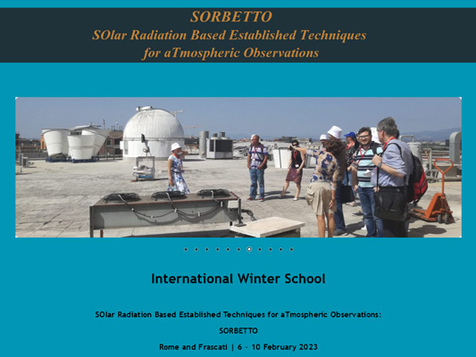
6-10 Feb. 2023
International Winter School
The SORBETTO (SOlar Radiation Based Established Techniques for aTmospheric Observations) Winter School was organised by ISAC-CNR, and held in Rome and Frascati.
Full details at:
http://sorbetto2.artov.isac.cnr.it
13-15 Sep. 2021
International Summer School
SOlar Radiation Based Established Techniques for aTmospheric Observations (SORBETTO).
Full details at:
http://sorbetto2.artov.isac.cnr.it/
MAPP Coordinator
Dr. Julian Gröbner
PMOD/WRC, Dorfstrasse 33
CH-7260 Davos Dorf, Switzerland
Tel: +41 81 417 51 57
E-Mail: julian.gröbner@pmodwrc.ch

